Town · Ligonier, Westmoreland County
Ligonier
Built around a green Diamond with a bandstand, a small Laurel Highlands town with shops and cafes in old storefronts, a reconstructed fort and the mountains close by.
Ligonier is a small, well-kept town in the Laurel Highlands, built around a square called the Diamond, with a bandstand in the middle and shops and cafes on every side. It grew up beside Fort Ligonier, which the British built in 1758 on their road west to the Forks of the Ohio, and the reconstructed fort stands a short walk from the Diamond.
The town fills up for Fort Ligonier Days each October, and in summer families come for Idlewild, the old amusement park just west of town. The long ridge of Laurel Hill rises to the east, with trails, trout streams and rustic cabins at Linn Run State Park, and the Flight 93 National Memorial is about forty minutes' drive away.
Make a day of it
In and around Ligonier
Fort · Ligonier, Westmoreland County
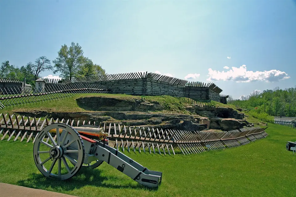
Fort Ligonier
A full-scale reconstruction of the British fort built in 1758 during the Forbes campaign, with earthworks, cannon and a museum of French and Indian War artifacts.
Photo: The original uploader was Mind meal at English Wikipedia ., CC BY-SA 2.0, via Wikimedia Commons
Amusement park · Ligonier Township, Westmoreland County
Idlewild and Soak Zone
Among the oldest amusement parks in the country, opened in 1878 along Loyalhanna Creek, with Story Book Forest, a Daniel Tiger trolley ride, classic rides and a water park.
State park · Cook Township, Westmoreland County
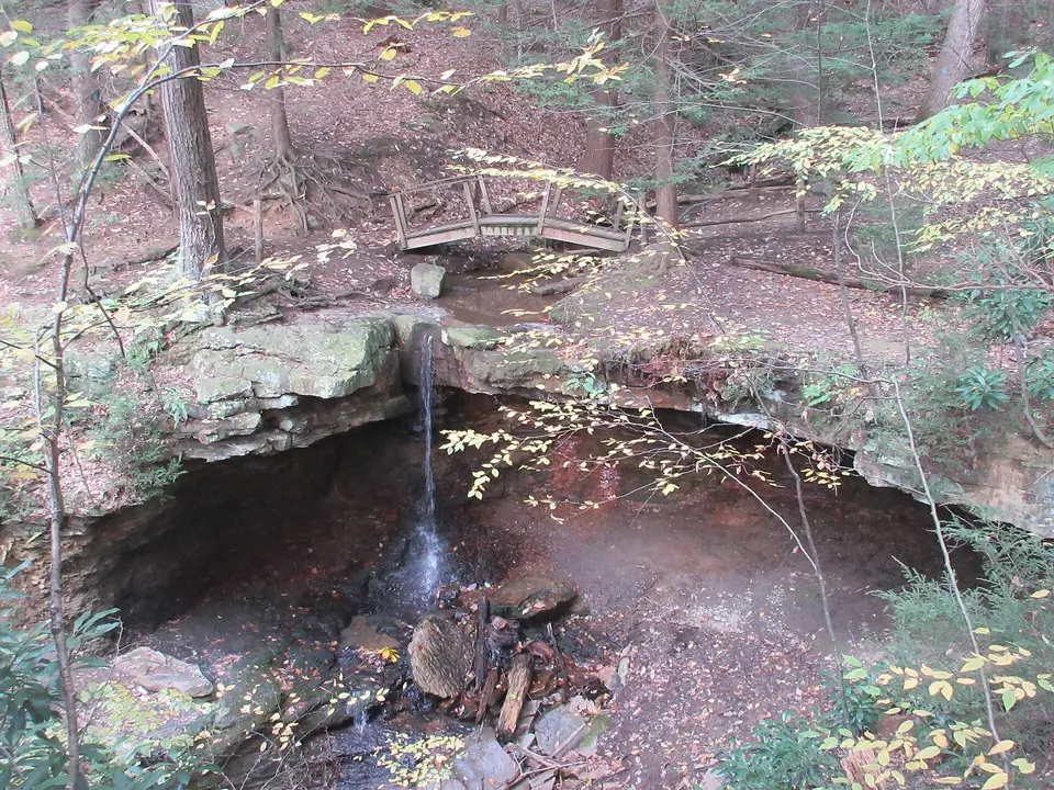
Linn Run State Park
A mountain stream tumbles over Adams Falls in this wooded hollow, with rustic rental cabins, trout fishing and trails climbing into the surrounding state forest.
Photo: VitaleBaby ( talk ) ( Uploads ), Public domain, via Wikimedia Commons
National memorial · Stonycreek Township, Somerset County
Flight 93 National Memorial
A memorial on the field where Flight 93 came down on September 11, 2001, with a visitor center overlooking the crash site, a wall of names and the 93-foot Tower of Voices.
Also nearby
Nearby
-
Fort Ligonier
A full-scale reconstruction of the British fort built in 1758 during the Forbes campaign, with earthworks, cannon and a museum of French and Indian War artifacts.
-
Idlewild and Soak Zone
Among the oldest amusement parks in the country, opened in 1878 along Loyalhanna Creek, with Story Book Forest, a Daniel Tiger trolley ride, classic rides and a water park.
-
Linn Run State Park
A mountain stream tumbles over Adams Falls in this wooded hollow, with rustic rental cabins, trout fishing and trails climbing into the surrounding state forest.
-
Laurel Mountain State Park
A ski area on the crest of Laurel Ridge, nearly 3,000 feet up, known for its steep runs and for the long views across the valley below from its slopes and lodge.
-
Forbes State Forest
Scattered high-country tracts of the Laurel Highlands, from Pennsylvania's highest point on Mount Davis to the Spruce Flats bog, with ridgetop trails, trout streams and room for backcountry rambles.
-
Laurel Summit State Park
A cool, breezy picnic ground near the top of Laurel Ridge that doubles as the starting point for walks to the rocky Wolf Rocks overlook and the Spruce Flats bog.